The Geology of Arches National Park
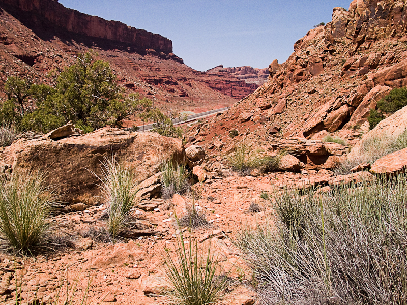
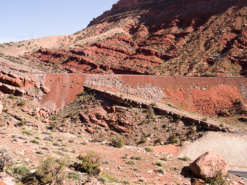
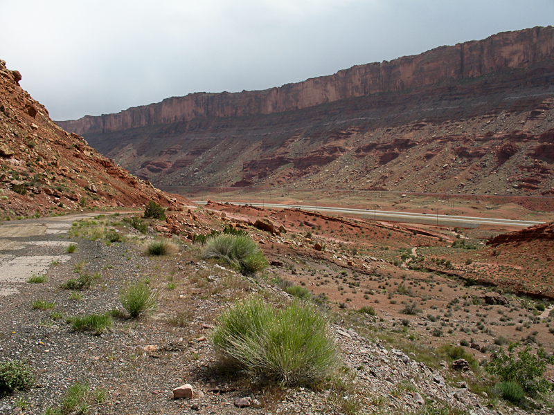
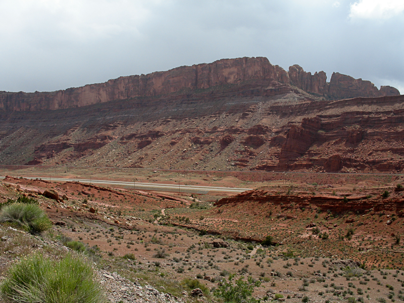
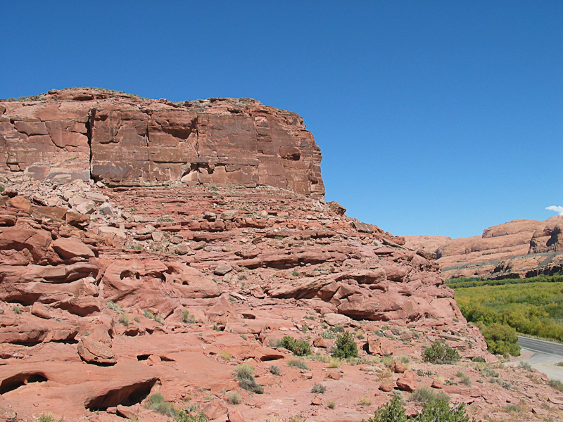
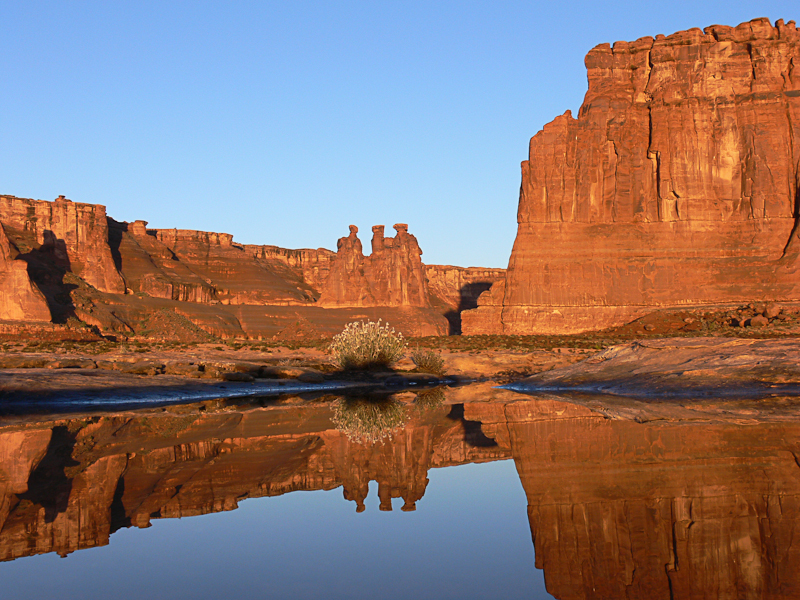
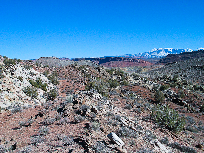
Cliffs formed by the Moab Fault above Hwy 191 near Moab, UT
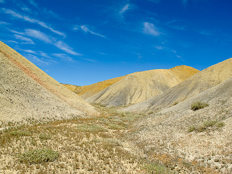
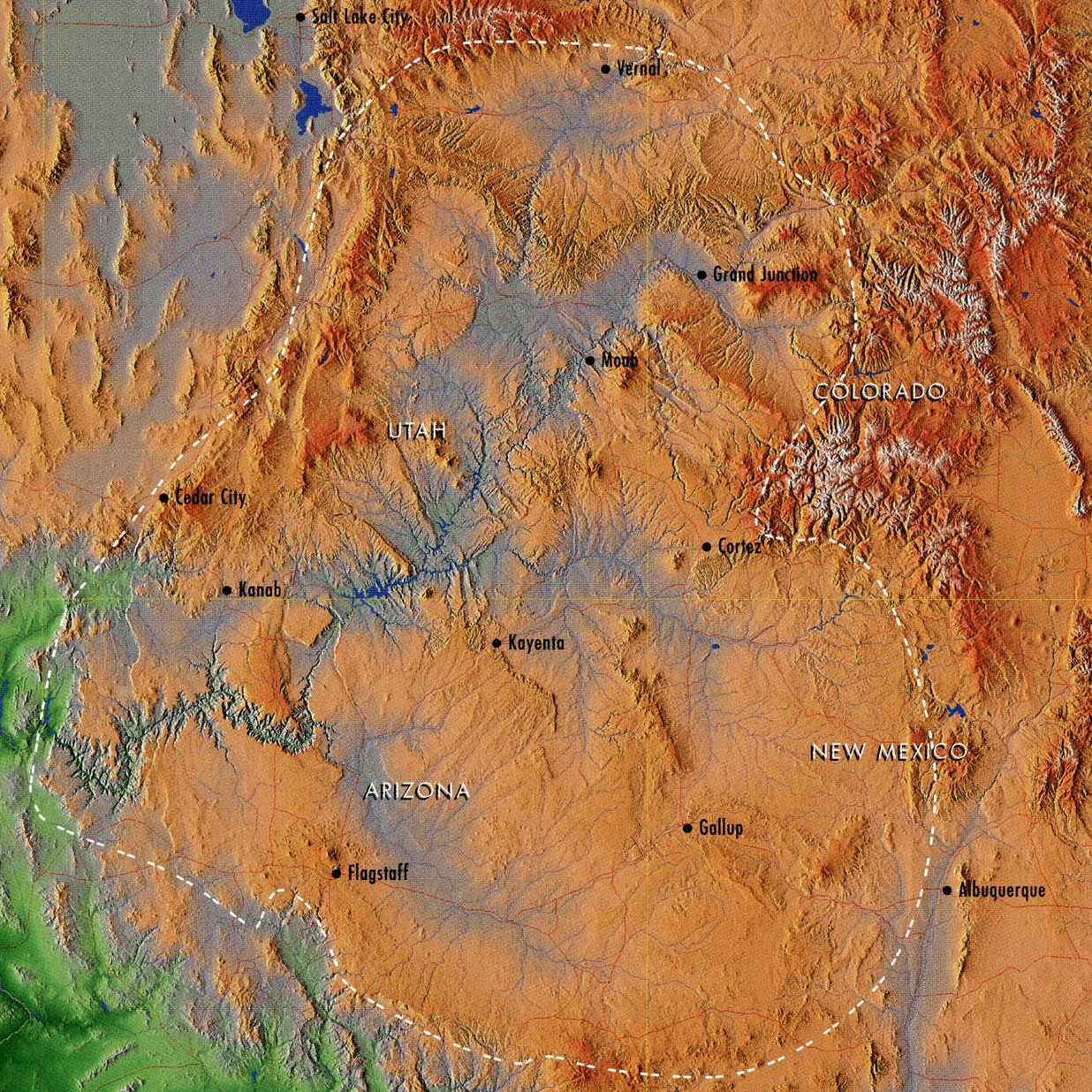 Map of the Colorado Plateau
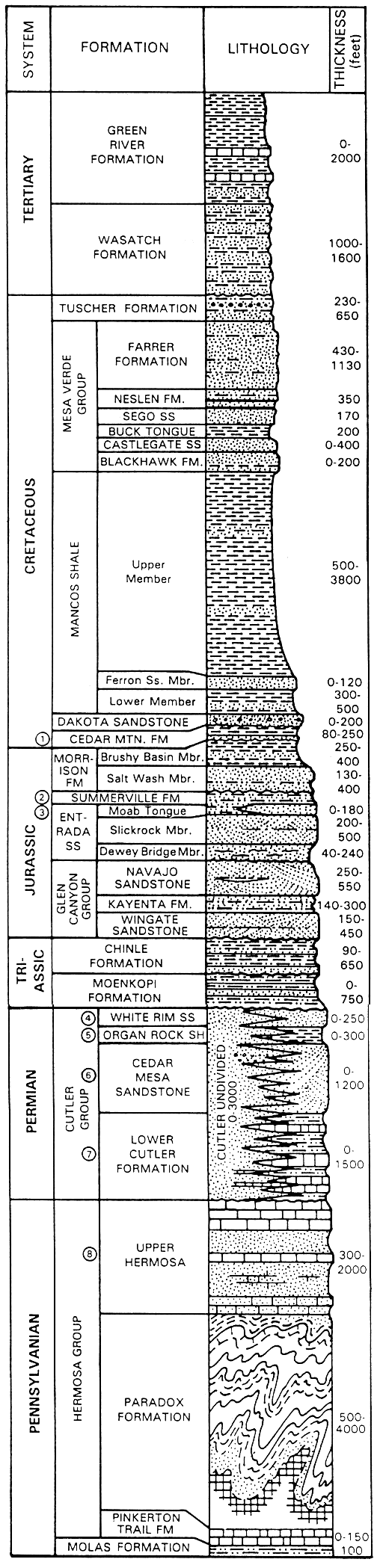
Arches and Canyonlands Geology Column Reference
Rock Strata
The following section describes the layers that are found in the Arches and Canyonlands region. They are quoted, with permission, from Signs of IMPACT! in Canyon Country, by F.A. Barnes, No. 57 of a series: pp. 26-31. The rock strata are listed in ascending order, starting with the oldest layer: the Paradox Formation.
The Paradox Formation
This deposit is comprised essentially of evaporites - various marine salts - that accumulated in a great, almost land-locked basin over a long period of time. Different salts were deposited selectively in layers and areas of the immense basin because of variations in their solubility. In places, major deposit intervals are marked by black layers of carbonized vegetation, indicating that some types of plants had adapted to the extremely saline conditions. The carbonized layers represent various times when the Paradox Basin had evaporated to a low level before once again being flooded by sea water flowing through renewed gaps in the surrounding uplifts. These uplifts created the basin to begin with during a period of accelerated tectonic activity, probably initiated by the energy generated as the suporcontinent, Pangea, began the long, complex process of breaking up. As exposed by erosion, Paradox salts are gray-hued and somewhat crystalline in appearance.
Paradox Formation
Upper Hermosa
This variable spectrum of deposits (aka Honaker Trail Formation) is made up mostly of sediments from the massive Uncompahgre Uplift to the east that accumulated in the Paradox Basin, very slowly filling it. They vary from shallow-marine reef limestone to iron-rich, sandy muds. Upper Hermosa deposits are thus largely red sandstones alternating with layers of gray, fossiliferous limestone.
Upper Hermosa
Lower Cutler
Deposits for this formation also came from the Uncompahgre, but were those laid down after the Paradox Basin had filled, making them land deposits. They were also iron-rich. Lower Cutler deposits are thus mostly dark red sandstone. Three other units of the Cutler Group also occur in the region and are distinguished in this book because they essentially act as different deposits. They are described next.
Lower Cutler
Cedar Mesa Sandstone
This deposit is a mixture of coastal sand dunes and iron-tinged, water-borne sediments from the Uncompahgre, giving it a white and red color-banded appearance. In the described region, it occurs only in the foothills of the Abajo Mountains.
No image available
Organ Rock Shale
Again, the source of the deposit was the Uncompahgre, with the fine coastal-marine and tidal flat shales laid down in thin layers that are usually dark red from their high iron content.
Organ Rock Shale
White Rim Sandstone
This deposit is limited in its present exposure. Its largely white, wave-washed coastal-beach dune and tideland deposits provide its name, although over time the porous sandstone absorbed minerals that are presently exposed in places as patches or layers of vivid color. The beach was the shoreline of a tongue of a western sea that invaded the region briefly, with a narrow bay reaching as far east as the present-day Castle Valley.
White Rim Sandstone
Moenkopi Formation
This thinly layered deposit consists of coastal floodplain and shallow-marine sediments. It varies from reddish to brown. Some geologists think that the brown, lower part is more closely related to White Rim Sandstone than to the Moenkopi.
Moenkopi Formation
Chinle Formation
This deposit varies considerably from place to place but represents a region dominated by lakes, swamps, rivers and streams. Sporadic volcanism in nearby regions colored the deposits with mineral-rich volcanic ash, providing blue-gray coloration to some Chinle layers, while others are varicolored sandstones. The long lifeless period followed the end of the Chinle deposition.
Chinle Formation
Wingate Sandstone
This cliff-forming sandstone is composed of coastal desert sands that for some unknown reason were frequently leveled and reworked by flooding. Wingate cliffs are generally red-hued but can vary in some regions. This is the first deposit made during a 40-million-year "Great Desert Period" in the canyon country region that was interrupted briefly only once by wetter times. The region was located in an equatorial position on Pangea during that extended period, resulting in a very hot, arid, windy climate broken only now and then by powerful equatorial storms. The Wingate environment was lifeless until very near its end, when a few small predator dinosaurs began to invade the region, although what they were seeking in such barren lands remains a mystery.
Wingate Sandstone
Kayenta Formation
This normally light-hued, layered sandstone was deposited by lakes and streams. Some life existed in the region then, as the dinosaurs that began to adapt to the Wingate environment expanded into the more favorable Kayenta biosphere. These provide paleontologists fairly accurate points on the time scale. This was the one brief, anomalous wetter interval during the Great Desert Period. Its duration is unknown, but was long enough for a wide range of plant and animal life to become well established.
Kayenta Formation
Navajo Sandstone
This basically white sandstone is largely desert-dune sand, with other types of deposits at irregular intervals. Some of these were red, iron-rich sediments washed down from higher terrain by flash-flooding. Others were once playa dry-lakes whose mineral deposits eventually turned to gray limestone in layers that vary from a few inches to several feed in thickness. In many areas, black mineral layers and columns of unknown origin are exposed by weathering. Over a very long period, some of the life that existed during Kayenta deposition adapted to the more rigorous conditions that this desert offered. Navajo is easily the most complex and least understood of canyon country deposits.
Navajo Sandstone
Entrada Sandstone
In most of the canyon country region, this varied deposit has three distinct members that are so different from each other that for purposes of this book they must be described separately. Very few of the life forms that existed during the earlier Kayenta and Navajo times survived into Entrada times.
Entrada Sandstone
Entrada Sandstone - Dewey Bridge Member
This mineralized deposit is made up largely of thick layers of dark red, sandy muds. Most of it is divided into two distinct units. In a few exposures, the upper unit layers have a "wrinkled" appearance. The rock is composed of freshwater flood-plain deposits that phase into varied tideland sediments farther west. Large quantities of colorful quartz known as "Dewey Bridge Agate" erode from its lowest levels. Although this was supposedly a freshwater deposit, the general region remained hot, arid, windy and utterly lifeless. As with other red-hued strata in the region, Dewey Bridge deposits came from the low remnants of the ancient Uncompahgre Uplift, which later rose again.
Dewey Bridge
Entrada Sandstone - Slickrock Member
Once more, the arid desert environment returned, leaving deep, light red dune-sands. This desert was often heavily flooded, leveling the huge dunes and leaving thin horizons between angled dune-sand layers of various thicknesses. In a few places, flat beds of gray, yellow and black sandstone signify where inland lagoons left by the periodic flooding lasted for some time.
Slickrock
Entrada Sandstone Moab - Tongue Member
This white beach and tideland sandstone was deposited over part, but not all, of the lower members of Entrada. It represents the coastal deposits along the shores of a tongue of an inland sea that penetrated the canyon country region from the northeast. In one narrow stretch it mysteriously inter-layered with the next younger deposit.
Moab Tongue
Summerville/Tidwell Formation
The Entrada members are overlain with this dark red, mineral-rich tidal-plain deposit. In parts of canyon country, similar-appearing deposits of the same age but of different origin are called the Tidwell Member of the Morrison Formation, however for practical purposes they are the same deposit. This is the last of the long series of deposits that hosted little if any life. After its deposition, large quantities of quarts, manganese oxides and other minerals formed within this red-mud deposit in some areas.
Summerville/Tidwell Formation
Morrison Formation
As with the Entrada, this deposit is divided into members which are quite different from each other. The onset of Morrison deposition marked the end of the 40-million-year-long Great Desert Period. Descriptions of the two Morrison members follow.
Morrison Formation
Morrison Formation - Salt Wash Member
This member consists largely of thick layers of light-hued sandstone, interspersed with thin, softer strata. In much of the region, this member is quite deep. Its depositional environment was lakes, streams and rivers, which hosted the return of life to the region.
Salt Wash
Morrison Formation - Brushy Basin Member
Changes in the general region brought finer sediments that were laced with ash from volcanoes farther west. Its broad, shallow streams and lakes deposited fine shales that are banded with various "painted desert" mineral hues. This environment was also favorable to prolific life. According to the conventional view, there was a very long interval of time between this deposit and the quite similar one that followed. The duration of this interval is highly questionable.
Brushy Basin
Cedar Mountain - Burro Canyon Formation
These two deposits are essentially the same but were given different names in adjacent areas of the canyon country region. They are also closely similar to the Brushy Basin member of the Morrison Formation in that they are layered, "painted desert" deposits, with one exception. Either at their base, or within them - depending on the geologist or paleontologist telling the story - there is an anomalous layer of very hard, coarse-grained sandstone that varies in thickness. Conventional theory does not explain this strange deposit. The Cedar Mountain-Burro Canyon depositional environment was also very favorable to life.
Cedar Mountain
Dakota Sandstone
This light brown sandstone was deposited by the freshwater rivers, streams and shallow lakes bordering an inland sea that was invading the region due to a gradual rise in global sea level. The region hosted prolific plant and animal life. Slowly, this deposit was buried beneath marine shales. Within the canyon country region covered by this book, Dakota Sandstone is not widely exposed.
Dakota Sandstone
Mancos Shale
The invading sea left deep deposits of shale ranging in color from light gray to black. Fossils of marine life are common in it. There are numerous anomalous members of this immense deposit, but only one exists in this region, the Ferron Sandstone member. This consists of light brown sediments that were carried into the sea by a river. It, too, hosted shallow-marine life. Mancos Shale is exposed over large areas of canyon country, and is especially prominent as strangely eroded crenelations along the base of the Book Cliffs.
Mancos Shale
Mesa Verde Group
This deposit is quite varied in appearance and composition and thus consists of numerous members. It represents the changing shoreline environment of the region as the Mancos Shale sea slowly, sporadically retreated. It is thus a mixture of land and coastal-marine deposits. The environment hosted a wide variety of life, both plant and animal. In this region, it is exposed only in the Book Cliffs. Some geologists separate the final member of the Mesaverde Group and call it the "Tuscher Formation". This is essentially a variety of freshwater sediments. Life was prolific to the very end of this deposit, however it is labeled. Its deposition period was terminated by the major meteorite impact that killed the dinosaurs and many other forms of life.
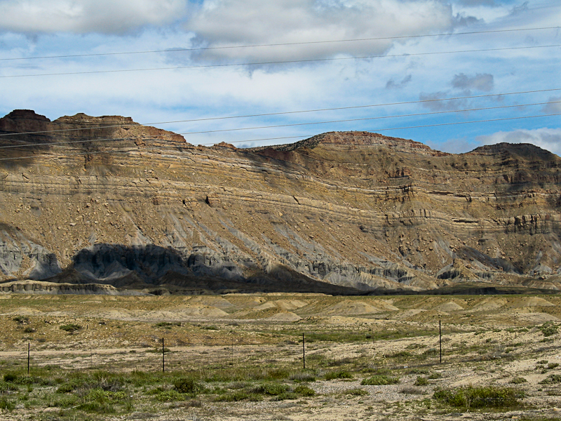
Mesa Verde Group